History & cultureGenefallThe Mercury Laced Latrine of Lewis and Clark Expedition Just Got Even Stranger
The Mercury Laced Latrine of Lewis and Clark Expedition Just Got Even Stranger
Long-form9:57Education4.3× channel median
Published Oct 13, 2026, 4:44 PM · 3d ago

Genefall
3.9K subscribers · median 8.2K views
AI imagery · confirmed$Likely
Views
35,402
+9 views/hour
Likes
279
0.8% of views
Comments
20
0.06% of views
Checked every 3 h while the video is this age · last check 1h ago · next in 96 min. YouTube itself updates public counts with a short delay.
Views / hour now
9
measured 1h ago
Peak views / hour
145
1d ago
Avg views / day
9.4K
since upload
First 24 hours
—
not tracked from upload
vs channel median
4.3×
Rank in channel
#4
of 20 tracked
Engagement
0.8%
likes + comments / views
Est. ad revenue
$142–$319
lifetime, $4–9 RPM
Views over time
7 readings · line: total views · bars: views gained per hour
Description
Out of eight thousand miles crossed by the Lewis and Clark expedition, only one campsite has ever given archaeologists physical proof in the soil where the men actually stood. That site is Travelers' Rest in western Montana, and it was found not by reading the journals alone, but by combining a Revolutionary War military manual with forensic soil science. By using Baron von Steuben's layout regulations for army camps, researchers discovered a latrine trench loaded with mercury from powerful medical purges known as thunderbolts, alongside a puddle of melted lead traced directly back to an ore deposit in Kentucky. This video explores how modern science uncovered the hidden chemical footprint of America's most famous journey.
Video Timestamps:
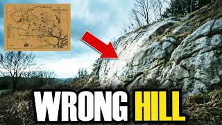
0:00: The Wrong Location on the Map
0:38: Finding Travelers Rest on Lolo Creek
2:19: Geologists and Coordinates Reveal the Real Camp
3:08: Using Baron von Steuben and the Military Manual
4:18: Dr Rush and the Mercury Laced Thunderbolts
6:32: The Cooking Hearth and Trade Beads
7:33: Gunsmithing and the Puddle of Melted Lead
8:28: Lead Isotopes Point to Kentucky
9:02: Missing Records and the Paper Trail
9:41: Walking Out to the Bench Above the Creek
Scientific and Historical Insights:
- Travelers Rest Location: Decades of mapping relied on a landmark at the mouth of Lolo Creek, but recalculating the captains coordinates proved the actual camp sat a mile and a half upstream.
- Military Encampment Manual: Archaeologist Dan Hall used magnetometer surveys and Baron von Steuben's drill manual to locate the camp layout, predicting where tents, fires, and latrines belonged.
- Mercury Calomel Pills: Men swallowed Dr Benjamin Rush's bilious pills containing mercury chloride, leaving twenty seven positive soil samples twenty two to twenty nine inches deep in the latrine trench.
- Lead Isotope Fingerprinting: A puddle of melted lead left in a campfire during gunsmithing sessions in July eighteen oh six matched ore signatures from the Olive Hill region of northeastern Kentucky.
Tags
lewis and clarklewis and clark expeditioncorps of discoverytravelers resttravelers rest state parklewis and clark campsitemercury latrinerush's bilious pillsthunderclappersmeriwether lewiswilliam clarklolo montanabitterroot mountainslewis and clark archaeologyamerican historyhistory documentaryarchaeology documentarymontana historysacagawealead isotope analysislewis and clark mysteryfrontier historylewis and clark trail
Details
- Published
- Oct 13, 2026, 4:44 PM
- Length
- 9:57 (597 s)
- Format
- Long-form
- Category
- Education
- Audio language
- EN
- Quality
- HD
- Captions
- No
- Made for kids
- No
- Licensed content
- Yes
- Video ID
- 3DW0RJ7kV1k
More from Genefall
 Scientists Found Out What Really Happened Inside The Last of the Mohicans Fort388 views · 1d ago
 Something About the Mayflower Pilgrims Doesn’t Make Sense Anymore15.5K views · 5d ago · +43/h
 Archaeologists Unearthed Something in Georgia That Doesn’t Match the Mound Builder Story470 views · 1w ago
 They Found 100 Viking Objects in One Hole, But Something Was Very Wrong1.1K views · 1w ago
 The 63 Foot Mound in Georgia Nobody Has Ever Opened2.9K views · 1w ago
 Something About Salem's Execution Site No Longer Makes Sense18K views · 1w ago · +6/h
 Archaeologists Unearthed Something in Wyoming That Doesn't Match the Comanche Timeline575 views · 2w ago
 Death Valley's Moving Rocks — A Seventy Year Mystery, Solved1.5K views · 2w ago
Statistics from the YouTube Data API, tracked by FameX. Views per hour, revenue and comparisons are FameX estimates.