Education & explainersDT Civil CoreInside Nepal’s Disaster Corridor — Why Roads and Hydropower Shared One Valley?
Inside Nepal’s Disaster Corridor — Why Roads and Hydropower Shared One Valley?
Long-form19:5621.3× channel median
Published Sep 12, 2026, 12:00 PM · 4w ago

DT Civil Core
3.9K subscribers · median 1.4K views
AI imagery · confirmed$Likely
Views
30,198
+0 views/hour
Likes
64
0.2% of views
Comments
27
0.09% of views
Checked every 24 h while the video is this age · last check 1h ago · next in 1322 min. YouTube itself updates public counts with a short delay.
Views / hour now
0
measured 1h ago
Peak views / hour
—
Avg views / day
915
since upload
First 24 hours
—
not tracked from upload
vs channel median
21.3×
Rank in channel
#1
of 20 tracked
Engagement
0.3%
likes + comments / views
Est. ad revenue
$121–$302
lifetime, $4–10 RPM
Views over time
0 readings · line: total views · bars: views gained per hour
Live tracking started
The chart fills in as FameX records new readings.
Description
On August 26, 2026, a catastrophic disaster began high in the Himalayas near Nepal’s border with China.
Preliminary U.S. Geological Survey analysis describes a rapid slope failure involving a glacier that likely triggered a debris flow and flood. The destructive flow then traveled nearly 100 kilometers through the downstream river system.
But this documentary asks a different question:
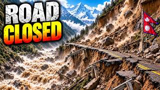
Why were roads, hydropower projects, settlements, workers, travelers and a major trade corridor concentrated inside the same narrow Himalayan valley?
The answer is an engineering paradox.
In terrain this steep, river valleys provide some of the most practical corridors for roads, access, trade and hydropower. But those same valleys can also direct water, rock, ice, mud and debris toward the infrastructure built inside them.
This film follows the full engineering story — from Himalayan terrain and mountain-road design to hydropower geography, debris-flow entrainment, valley confinement, damaged access, underground isolation and the difficult question of how infrastructure can become more resilient.
This is not a story about people simply choosing the “wrong” place.
It is about what happens when the geography that makes development possible is also capable of carrying extreme hazards through the same corridor.
Topics covered:
Nepal Himalayan infrastructure
mountain road engineering
hydropower engineering
debris flows
landslides and glacier-related hazards
river-valley infrastructure
bridge and road vulnerability
tunnel access
disaster resilience
early warning and monitoring
civil engineering in extreme terrain
Primary factual references include the U.S. Geological Survey, Nepal government and infrastructure authorities, Reuters reporting, and institutional engineering sources.
This video uses documentary reconstruction and explanatory visualization where authentic event footage or exact historical geometry is not available.
CHAPTERS
00:00 The Valley That Became a Disaster Corridor
01:20
Tags
Nepal disaster 2026Nepal flood 2026Nepal debris flowHimalayan disasterHimalayan engineeringNepal hydropowerNepal infrastructureRasuwa NepalRasuwagadhiTrishuli Riverdebris avalanchedebris flow engineeringlandslide engineeringglacier related hazardcivil engineering documentary
Details
- Published
- Sep 12, 2026, 12:00 PM
- Length
- 19:56 (1,196 s)
- Format
- Long-form
- Category
- —
- Audio language
- —
- Quality
- —
- Captions
- —
- Made for kids
- —
- Licensed content
- —
- Video ID
- g0mEGvBMExU
More from DT Civil Core
 What Really Triggered the Nepal–Tibet Mountain Collapse? New Evidence Explained642 views · 2w ago
 Why Engineers Build Hydropower Plants Inside Himalayan Mountains (Full Process)1.4K views · 2w ago
 Why Himalayan Bridges Fail Even When the Bridge Is Strong?1.9K views · 2w ago
 How Nepal Rebuilds Himalayan Highways After the Mountains Destroy Them2.2K views · 3w ago
 How the UAE Is Building a Second Oil Pipeline to Bypass the Strait of Hormuz1.2K views · 3w ago
 Road or Tunnel How Engineers Choose Routes Through Nepal’s Himalayas1.5K views · 3w ago
 Why Nepal Keeps Building Roads Through the Himalayas — Even When the Mountains Keep Destroying Them2.1K views · 3w ago
 Nepal Built a Highway Through the Himalayas — Then the River Took the Road Back7.7K views · 3w ago
Statistics from the YouTube Data API, tracked by FameX. Views per hour, revenue and comparisons are FameX estimates.