America’s Geographic Nightmare 🇺🇸 New Orleans Flooding 🌊
Short1:33EducationPublished Oct 22, 2026, 3:08 PM · 3d ago
Views
577,727
+3,473 views/hour
Views / hour now
3.5K
measured 1h ago
Peak views / hour
3.5K
1h ago
First 24 hours
—
not tracked from upload
Engagement
3.3%
likes + comments / views
Likes
18.5K
3.2% of views
Comments
641
0.11% of views
Est. ad revenue
$17–$46
lifetime, $0.03–0.08 RPM
Checked every 3 h while the video is this age · last check 1h ago · next in 117 min. YouTube itself updates public counts with a short delay.
Avg views / day
156K
since upload
vs channel median
0.1×
this video's views ÷ the channel's usual
Rank in channel
#18
of 20 tracked
Views over time
4 readings
Total views Views gained per hour
Description
This American city was once so valuable that the United States wanted to buy it from Napoleon. But today, that same location has become a geographic nightmare 🇺🇸 That city is New Orleans. In the early 19th century, the Mississippi River and its tributaries connected central North America to the sea. Whoever controlled the city controlled this vital trade route, which is why the U.S. bought it from France in the Louisiana Purchase of 1803 💵 Today, the challenge is keeping New Orleans from drowning. The city and its metropolitan area are almost completely surrounded by water: Lake Pontchartrain to the north, the Mississippi River in the middle and the Gulf of Mexico to the south and east 🌀 Hurricane Katrina left 80% of the city underwater in 2005. Much of New Orleans lies below sea level, sitting in a bowl that can fill during major floods 🌊 Authorities have spent billions on levees, floodwalls and pumps to protect it from flooding. The water that once made the city so valuable now threatens its survival.
#neworleans #louisiana #americanhistory #usa #mississippiriver #hurricane #louisianapurchase #lakepontchartrain #gulfofmexico #learn #maps #learning #history #geography
Tags
new orleanslouisianaamerican historyusamississippi riverhurricanelouisiana purchaselake pontchartraingulf of mexicolearnmapslearninghistorygeography
Details
- Published
- Oct 22, 2026, 3:08 PM
- Length
- 1:33 (93 s)
- Format
- Short (3 min or less)
- Category
- Education
- Audio language
- EN
- Quality
- HD
- Captions
- No
- Made for kids
- No
- Licensed content
- Yes
- Video ID
- iaeYlPNeZio
More from GeoGlobeTales
 How Brazil Got Its Borders 🇧🇷🤯 Spain vs Portugal 🇪🇸🇵🇹535K views · 1d ago · +5.2K/h
 Why the Caspian Sea is Not a Sea 🌊🤯 World's Largest Lake1.4M views · 1w ago · +1.2K/h
 How Can France Border the Netherlands? 🇫🇷🇳🇱 Saint Martin 🤯1.4M views · 3w ago · +398/h
 What Is El Niño & Why Is It So Powerful 🌡️🤯 Super El Niño 🌊3.5M views · 5w ago · +1.1K/h
 Why People Settled the Most Remote Island 🏝️🤯 Tristan da Cunha3M views · 6w ago · +2K/h
 Why Virginia Split Into Two States 🇺🇸🤯 Union vs Confederacy3.5M views · 7w ago · +951/h
 The True Size of Hawaii 🏝️ #Hawaii #USA #Geography2.3M views · 2mo ago · +774/h
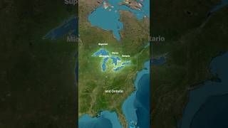 Why the Great Lakes Are So Great 🤯 #GreatLakes #USA #Canada2.7M views · 2mo ago · +1K/h
Statistics from the YouTube Data API, tracked by FameX. Views per hour, revenue and comparisons are FameX estimates.