A 1597 Map Drew a Walled City Where the White House Stands Today
8.1× channel medianLong-form10:00EntertainmentPublished Aug 24, 2026, 3:22 PM · 2mo ago

Views
181,550
+287 views/hour
Views / hour now
287
measured 20h ago
Peak views / hour
287
20h ago
First 24 hours
—
not tracked from upload
Engagement
2.6%
likes + comments / views
Likes
4.4K
2.4% of views
Comments
353
0.19% of views
Est. ad revenue
$726–$1,634
lifetime, $4–9 RPM
Checked every 24 h while the video is this age · last check 20h ago · next in 183 min. YouTube itself updates public counts with a short delay.
Avg views / day
3K
since upload
vs channel median
8.1×
this video's views ÷ the channel's usual
Rank in channel
#3
of 21 tracked
Views over time
0 readings
Total views Views gained per hour
Live tracking started
The chart fills in as FameX records new readings.
Description
part 2: https://youtu.be/FJwLZEJkcpg
What if Washington DC was built on top of a forgotten kingdom — one that appears on almost every world map drawn before 1650?
Everyone is asking what lies beneath the Washington DC. The oldest version of that question was drawn on parchment four hundred years ago.
In this episode, we examine the maps themselves: Antonio Pereira's 1540 chart showing established kingdoms along the eastern seaboard, Abraham Ortelius's 1570 map marking Norumbega as both a region and a city, and the strange hundred-year process by which the name faded from cartography entirely — gone by 1700.
SOURCES SHOWN ON SCREEN
· Antonio Pereira, 1540 chart
· Abraham Ortelius, Theatrum Orbis Terrarum, 1570
· Myths and Legends Beyond Our Borders, 1890
Some visuals in this video were created or restyled with digital tools, including AI-assisted imagery, for illustrative purposes. Historical maps and documents are shown from archival sources.
If you enjoy forgotten history told carefully, consider subscribing to Ink of the Past. One subscription genuinely helps this channel grow.
Tags
historyancient Americalost American citiesold mapsforgotten historypre-Columbian AmericaWashington DC historyancient civilizationshistorical maps1500s mapshidden historyancient North Americalost kingdomshistorical mysteriesearly Americaunexplained historyold world mapsCahokiamedieval mapsink of the past
Details
- Published
- Aug 24, 2026, 3:22 PM
- Length
- 10:00 (600 s)
- Format
- Long-form
- Category
- Entertainment
- Audio language
- EN-US
- Quality
- HD
- Captions
- Yes
- Made for kids
- No
- Licensed content
- Yes
- Video ID
- sC0RtWAm-Wg
More from Ink Of The Past
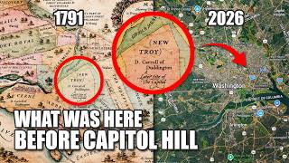 The U.S. Capitol Is Sitting on TROY?3.5K views · 22h ago · +55/h
 What Was Here Before the Catacombs of Paris?6.9K views · 5d ago · +30/h
 Noah’s Ark “100% CONFIRMED”… For the 5th Time?10.4K views · 1w ago · +2/h
 What Was Here Before Tokyo?15.3K views · 2w ago · +14/h
 NOBODY Knows What COLUMBUS Looked Like4K views · 2w ago · +2/h
 What Was Here Before The U S Capitol?22.3K views · 3w ago · +6/h
 What Was Here Before The Washington Monument?6K views · 4w ago · +2/h
 They Blamed The Weather For Burning Down Hundreds Of Cities5.2K views · 4w ago · +1/h
Statistics from the YouTube Data API, tracked by FameX. Views per hour, revenue and comparisons are FameX estimates.